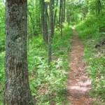
NC Hiking is Fun For All
NC hiking in the mountains can be a great way to enjoy the scenic beauty of the NC mountains. Whether its an easy mountain hiking trail just for the fun of it, or a moderate to severe hiking trail for the die hard adventurer, NC hiking is a great way to see the sites.
There are hundreds of NC hiking trails for all levels of hikers. A NC hiking trail can be an short easy stroll or a self guided nature walk at one of the visitors center. Or a trail can take you along the highest ridges of a mountain top with spectacular 360 degree views. Trails can be through quiet mountain forests next to quiet mountain streams. NC hiking can be whatever you want it to be-easy,peaceful and relax or invigorating, tough and challenging. See trail lists below.

NC hiking on a mountain trail can be for all seasons. In the spring you can enjoy the blooming rhododendron, blooming wild flowers and flowering trees. In the summer enjoy a cool walk in the shade of a mountain forest. A fall hike means fall foliage color show on a blanket of fresh fallen leaves. In the winter the views through a barren forest can bring scenic views not possible in the summer.
Before you start out you need to plan your NC hiking adventure
- Pick a trail type: easy, moderate or strenuous
- Know the weather
- Be prepared-food, snack and water
- First aid readiness
- Bugs, bears and snakes
Choosing a NC hiking trail
Decide how far you want to hike. Some trails are very short 1/2-1 mile, others are longer, and then there are the very long trails that require an overnight stay.
How strenuous if the trail? Easy, moderate or strenuous depends on the length of the trail, the change in elevation and the walking surface are factors in the degree of difficulty. Trail information charts are easy to find online, in local shops, and at the visitors center near trail locations.
Choose what type of hike you want to take. A forest hike, a hike along a mountain stream or brook, a hike to a waterfall, a hike to a ridge with mountaintop views, a hike to a bald, or a hike to a field of wild flowers. Each trail is different and offer a completely different hiking adventure.
Popular NC hiking trails by area
Cateloochee Area Hiking Trails
Caldwell Fork Trail
Rough Fork Trail
Great Smoky Mountains
Gregory Bald Overnight Loop
Appalachian Trail- a 2,174 mile trail along the ridges and thru the valleys of the Appalachian Mountains from Maine to Georgia. NC has numerous trails along the Appalachian Trail.
Clingmans Dome Tower– a 1 mile roundtrip hike to the highest point in the Great Smoky Mountains at 6,643 feet. Moderate paved hiking trail to the observation deck with panoramic views.
Linville Area
Grandfather Mountain-12 miles of hiking trails, all levels from easy to strenuous. Grandfather Trail is just one trail. Guided hikes with rangers. MP 305
Highlands Area
Whiteside Mountain-in the Nantahala National Forest. Has a 2 mile loop trail past 750-foot high sheer cliffs with spectacular views. Peaks at elevation of 4.930 feet. Moderate to strenuous.
Rainbow Falls-one of 4 waterfalls on a 2 or 3 mile trail along the Horsepasture River at Gorges State Park.
Looking Glass Rock-a 6 1/2 mile roundtrip hike to the top of a rock face with 180+ degree view.
Glen Falls- 1 1/2 mile roundtrip hike to the waterfalls Glen Falls. A less crowded trail off the beaten path.
Joyce Kilmer Memorial Forest- a 2 mile easy loop trail thru a hardwood tree forest with 400 year old poplar trees.
Brevard Area
Dupont Forest Waterfalls-a 3 mile hike to Hooker Falls, Triple Falls and High Falls. Moderate.
Mount Pisgah-1 1/2 mile hiking trail to a 5,721 foot summit (strenuous). Near MP 407 on the Blue Ridge Parkway
Graveyard Fields Loop Trail
Asheville Area
Mount Mitchell-Deep Gap Trail to Mt. Craig. a 2 mile roundtrip hike with views of Black Mountain and Mount Mitchell. Moderate. MP 355
Craggy Gardens-Craggy Pinnacle Trail. A 1 1/2 mile roundtrip hike with a panoramic view. MP 364
Green Knob Tower- 1 mile round trip hike with views of the Black Mountain range. MP 350
Chestoa View- a short 1/3 mile walk at the Chestoa View Overlook on the Blue Ridge Parkway. One of the best views on the parkway with spectacular views of the Linville Gorge. MP 320
Linville Falls-2 separate trails from the Visitors Center. 5 viewpoints of the Linville Falls waterfalls. MP 316
Blue Ridge Parkway Trails
Frying Pan Tower-1 1/2 mile roundtrip hike to the tower. MP 408
Graveyard Fields-has 2 waterfalls, wildflowers and a mile-high view of the Blue Ridge Mountains with 6,000 foot peaks. No graveyard, just stumps and trees that look like grave stones. About a 4 mile trail. MP 419
Devil’s Courthouse-1/2 mile strenuous trail to the peak and the sinister appearance of the bare rock. MP 422
Richland Balsam-1 1/2 mile loop trail to the highest summit of the Blue Ridge Parkway. MP 431

Hiking Tips
- Hike with another person and not alone
- Take a flashlight
- Take a whistle
- Wear appropriate clothes
- Dress in layers
- Have rain gear
- Wear a good pair of shoes
- Check the weather
- Take food, snack or water
Avoid getting lost
To prevent getting lost-tell someone your plans, which trail you are going to hike and take a trail map.
If you do get lost!
- Stay on the trail. The search for lost hikers start on the trail or areas nearest the trail.
- Stay calm and don’t panick.
- Stay together if in a group.
- Keep warm and dry to prevent hypothermia.
- If you need to find shelter stay as close to the trail as possible.
- If an injury occurs-to you or someone else:
- Keep warm and comfortable
- Leave someone with the injured hiker if possible and go for help.
- Look around and remember landmarks of exact location.
- Hike to get help
Bears, Bugs and Snakes
Bears:
- Observe from a distance
- Do not feed
2 types of poisonous snakes:
- Northern Copperhead
- Timber Rattlesnake
Only a few snakes bits occur.
Be cautious about where your put your hands and feet.
Yellowjacket wasps:
- Build nest in the ground
- Aggressive when disturbed
If stung causes local swelling. Allergic reaction is possible.
Lightning & Thunderstorms:
Avoid shelter from tall or solitary trees, rock outcroppings, overhangs and ridge-tops.
Lie in shallow depressions but away from water, tree roots or metal objects.
Poison Ivy:
Know what this plant looks like.
Contact causes an itchy rash and swelling.
Map of Hiking Areas
North Cove, NC 28752
Great Smoky Mountains, Great Smoky Mountains National Park, Forneys Creek, NC 28713
Nantahala National Forest, Robbinsville, NC 28771
Pisgah National Forest, East Fork, NC 28716
Franklin, NC 28734
Pisgah National Forest, South Toe, NC 28714
Saint Joe National Forest, Idaho 83812
Nantahala National Forest, Cashiers, NC 28741
Great Smoky Mountains, Great Smoky Mountains National Park, Cataloochee, NC 28785
